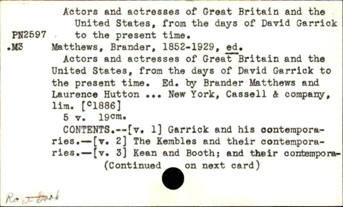
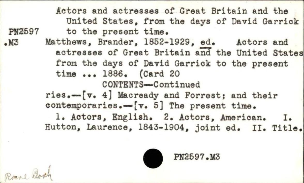
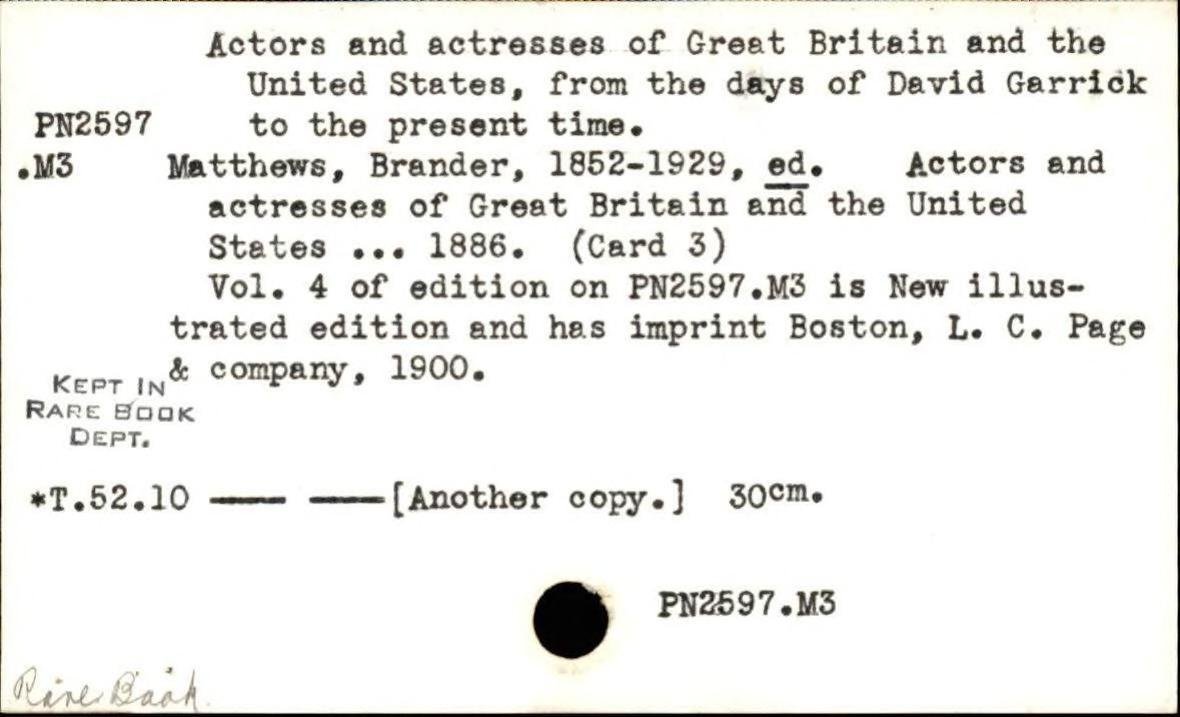
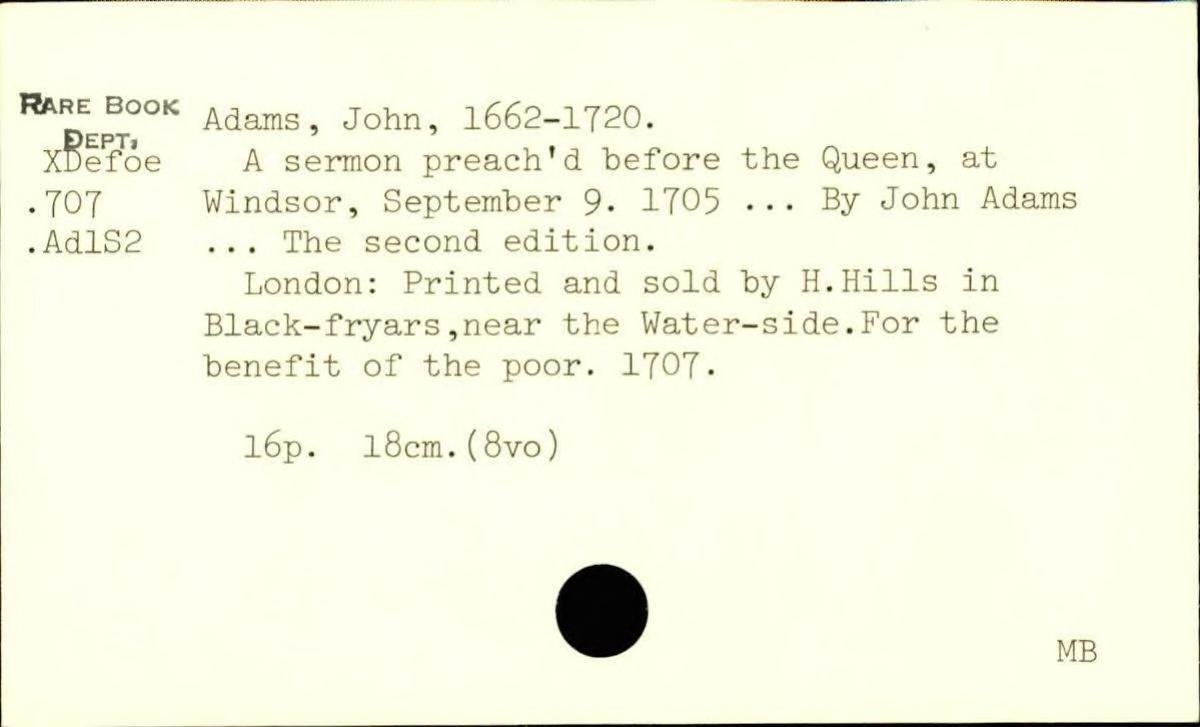
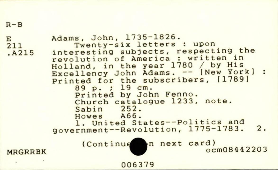
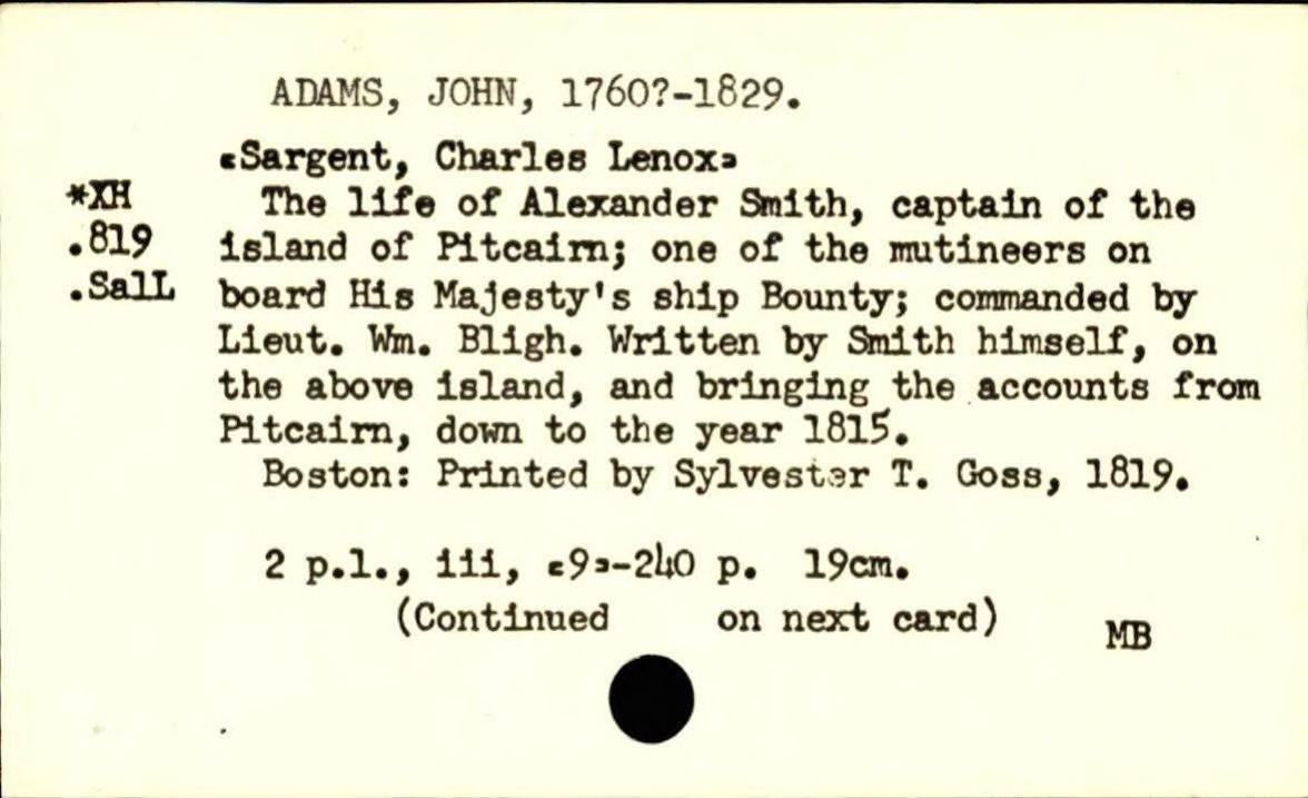
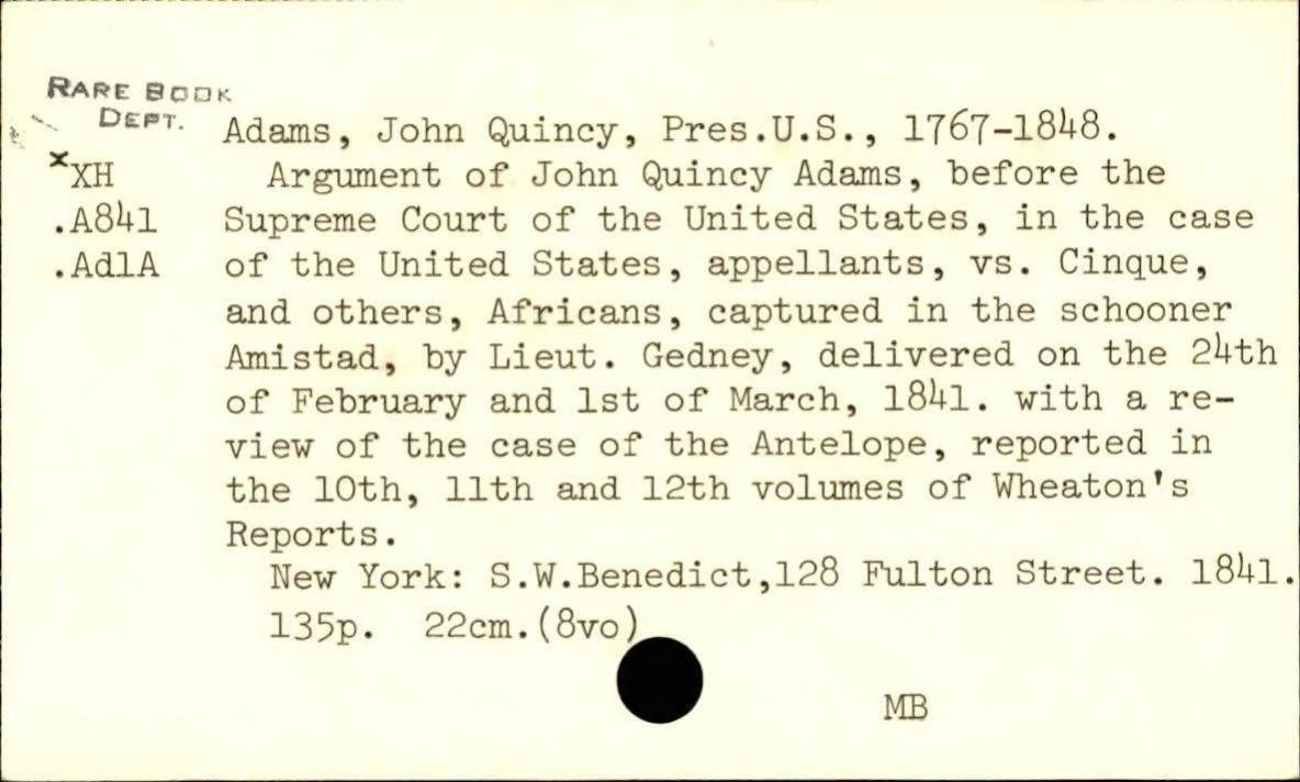
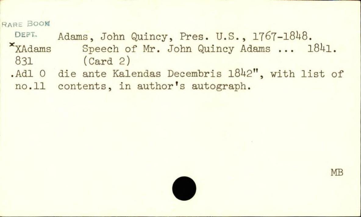
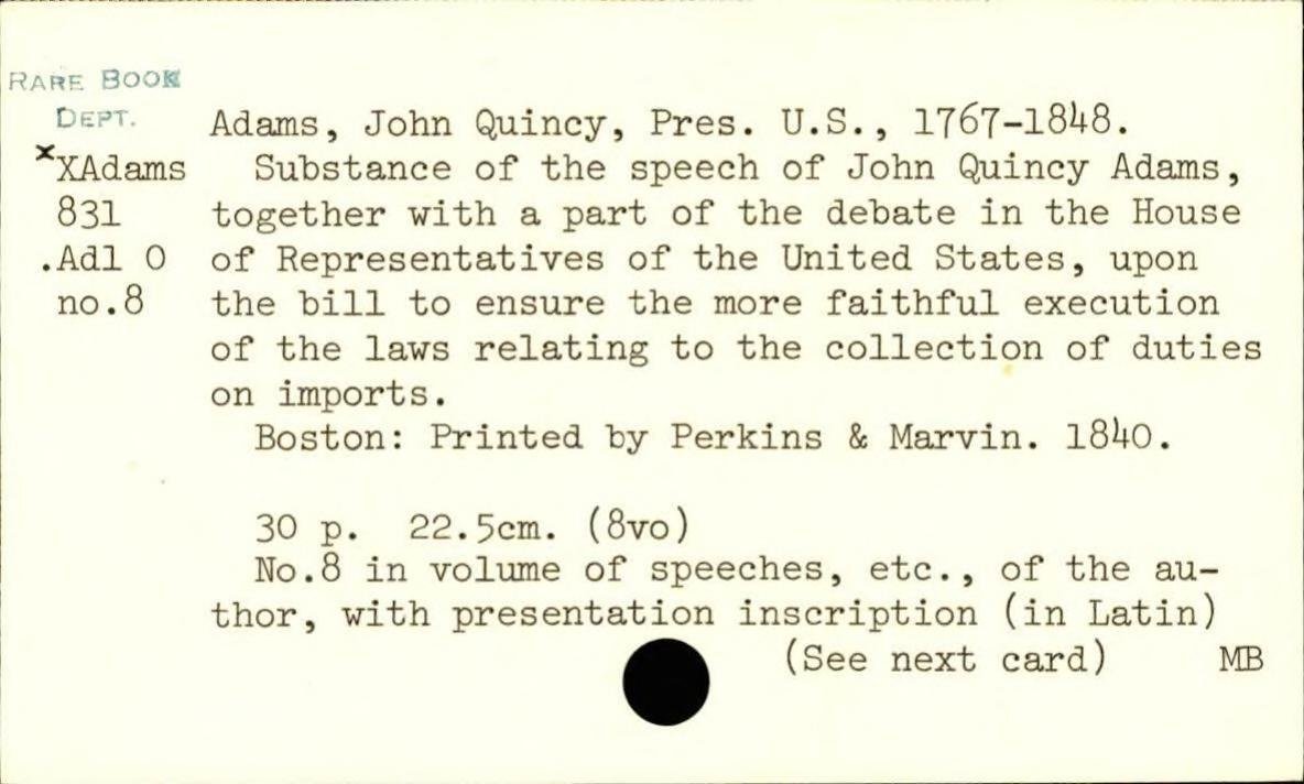
ILLINOIS RIVER.
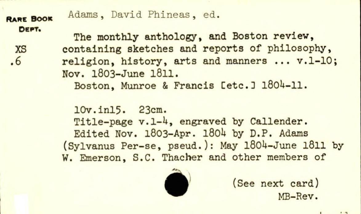
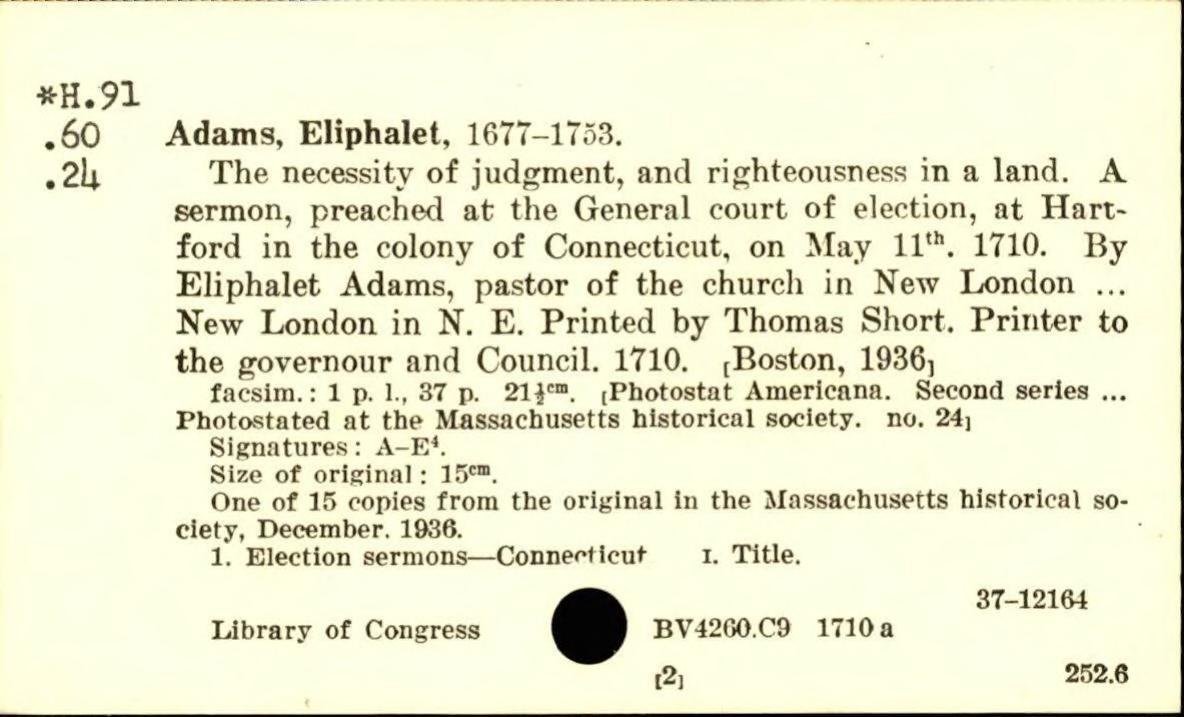
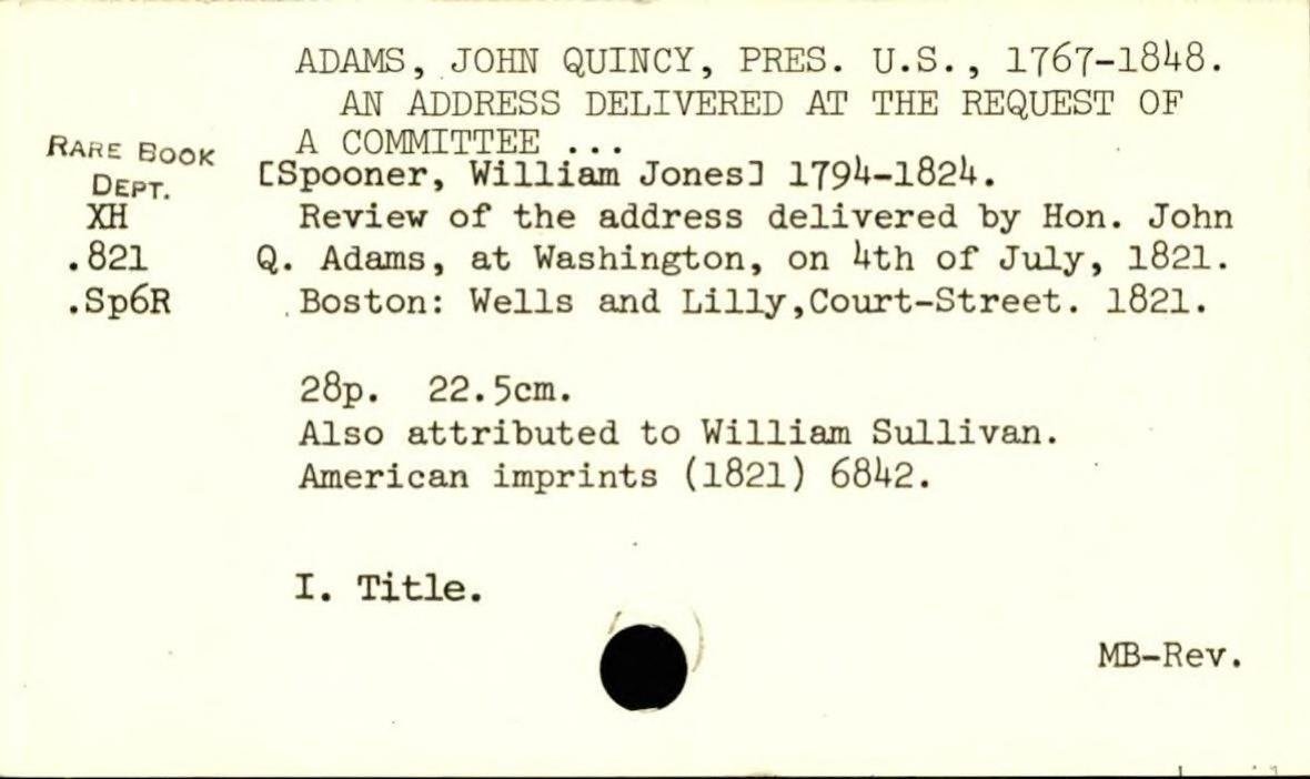
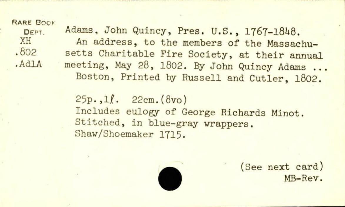
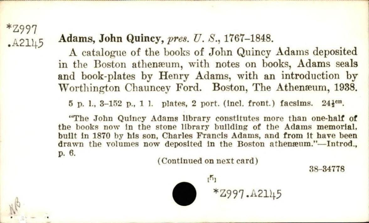
Hutchins, Thomas, 1730-1789.
A topographical description of Virginia, Pennsylvania, Maryland, and North Carolina, comprehending the rivers Ohio, Kenhawa, Sioto, Cherokee, Wabash, Illinois, Mississippi, &c. the climate, soil and produce, whether animal, vegetable, or mineral; the mountains, creeks, roads, distances, latitudes, &c. and of every part laid down in the annexed map. Published by Thomas Hutchins, captain ln [!] the 60th regiment of foot. With a plan of the rapids of the Ohio, a plan of the several villages in the Illinois country, a table of the distances between Fort Pitt and the mouth of the Ohio, all engraved upon copper. And an appendix, containing Mr. Patrick Ken-
(Continued on next card)
[39h1]